
Remembering a unique railway – the Weston, Clevedon & Portishead.
We are the only group dedicated solely to this railway.


Copyright © 2009-2026 WC&P Railway Group

|
Maps: Alan Godfrey Old Ordnance Survey |
|
|
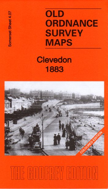
Sheet 4.07a - Clevedon - 1883 Coloured edition This version is in full colour, taken from the beautiful 1st Edition hand-coloured OS map. Coverage stretches from Clevedon Bay, the pier, and Salthouse Bay eastward to East Clevedon and All Saints church. Features include Clevedon Bay Pier, Salt House, Hangstone Quarry, Gas Works, GWR railway station, All Saints' Church and Christ Church. The maps include extracts from early directories on the reverse. Clevedon is famed most of all for its splendid pier. As a seaside resort it grew between 1850 and 1870 and still retains some of its genteel atmosphere today. It was also the terminus for two railways, the GWR's Clevedon branch and the Weston Clevedon & Portishead Light Railway. The GWR terminus is shown on this 1883 map, but the WC&PR is not shown. Published 2017. Introduction by Tony Painter. Approx. 15 inches to a mile scale. Price is £3.50 plus postage & packing CODE: MAP407a (RRP is £4.00) Please also see Map 4.07b – Clevedon 1903 (not colour) which does include the WC&PR. |
|

£3.50
Map: Clevedon 1883
